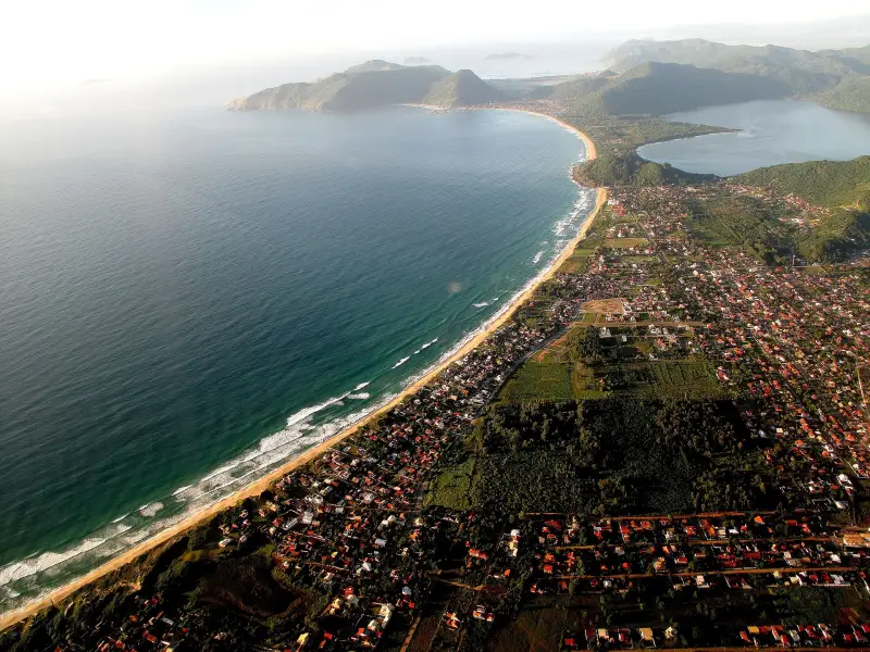
The north of the island lies on the coves of Baía Norte: the water is calmer and warmer than in the east and south, so families with small children go to Daniela, Forte, Jurerê, Ponta das Canas and Lagoinha. Ingleses, Brava and Santinho face the open ocean, there are waves: Ingleses, according to the Corpo de Bombeiros, ranks first in the city for drowning cases in January–September 2024. Swim only at the lifeguard post; in December 2025 there were posts on all beaches in the north.
The numbers for drownings are taken from the SC firefighters' statistics (afogamentos): this counts every drowning incident, including people who were rescued. It is a measure of the danger of the water, not the number of fatalities.
The north: lifeguard posts on the beaches
The beaches from Daniela to Ponta das Canas face the bay, and the cold upwelling of deeper water does not reach here — this is how a UFSC oceanographer explains why this is the warmest water on the island. From Lagoinha eastwards the ocean coast begins.
Lifeguard posts of the Corpo de Bombeiros (CBMSC) in the north, according to the corps' own table at the end of 2025:
| Beach | Posts in December 2025 | October–November |
|---|---|---|
| Daniela | 1 | weekends only |
| Praia do Forte | 1 | no |
| Jurerê | 2 | weekends only |
| Canasvieiras | 3 | in November and on weekdays |
| Cachoeira do Bom Jesus | 1 | weekends only |
| Ponta das Canas | 1 | no |
| Lagoinha | 1 | weekends only |
| Praia Brava | 3 | in November and on weekdays |
| Ingleses | 10 | every day |
| Santinho | 4 | every day |
The posts operate from 07:00 to 19:00. Out of season most are closed; the CBMSC Cidadão app shows which ones are open today; a black flag there means that there is no post. Water safety rules — in Water and drownings — rip currents, beach flags, what to do, surf spots — in Where to surf in Florianópolis and Santa Catarina — spots by name and where there are lifeguards.
Daniela — Praia da Daniela
Neighborhood Daniela, map point -27.4489, -48.5331.
The westernmost beach of the north, on the edge of the bay: the sea is very calm, shallow and warm, so it is called one of the best for small children. The length is about 3.5 km. In January–September 2024 there were only 2 drowning cases here — one of the lowest numbers in the city. Bus — line 271 Daniela from the TISAN terminal.
Forte — Praia do Forte
Neighborhood Praia do Forte, map point -27.4351, -48.5199.
A small calm beach under the Fortaleza de São José da Ponta Grossa, with little infrastructure. The water is warm; in January–September 2024 there were three drowning cases here. Bus — line 250 Forte / Canasvieiras from the TICAN terminal. The fortress is described in Fortresses and historical sites of Florianópolis — forts, Ponte Hercílio Luz, old center.
Jurerê
Neighborhood Jurerê, map point -27.4349, -48.4982.
Old Jurerê (Jurerê Tradicional): calm warm water, in the eastern part a fishing community has been preserved, the bay is good for sailing. Buses — line 272 Jurerê from TISAN and 940 Canasvieiras / Santo Antônio via Jurerê.
Jurerê Internacional — Praia de Jurerê Internacional
Neighborhood Jurerê Internacional, map point -27.4368, -48.5089.
The same bay, but the neighborhood was planned entirely as an upscale development, with hotels and beach clubs. The beach clubs have been in a legal dispute about demolition and licenses for more than fifteen years; whether each of them is operating now should be checked with the establishment itself.
Canasvieiras — Praia de Canasvieiras
Neighborhood Canasvieiras, map point -27.4268, -48.4611.
The busiest beach of the north in summer, popular with Argentine and Uruguayan tourists. The water is calm and warm, all infrastructure is nearby. The TICAN terminal is located in the neighborhood itself; lines 276 Balneário Canasvieiras and 262 Circular Canasvieiras. Water quality here varies: in the IMA SC report of 29 Oct 2026 three Canasvieiras points were unsuitable for bathing.
Cachoeira do Bom Jesus — Praia da Cachoeira do Bom Jesus
Neighborhood Cachoeira do Bom Jesus, map point -27.4189, -48.4386.
A continuation of Canasvieiras to the east, about 3 km of light sand, weak waves. Quieter than its neighbor. Buses — lines 260 and 280 from TICAN.
Ponta das Canas — Praia de Ponta das Canas
Neighborhood Ponta das Canas, map point -27.4029, -48.4319.
Calm sea with a gentle slope into the water, good for family swimming and SUP. Fewer people than in Canasvieiras. Bus — line 265 Ponta das Canas from TICAN.
Lagoinha — Praia da Lagoinha
Neighborhood Ponta das Canas, map point -27.3889, -48.4249.
Northern Lagoinha (not to be confused with Lagoinha do Leste in the south): a small bay about 760 m long, with almost no waves, the water is clear and shallow. There is no dedicated bus line. From Praia Brava a trail leads here through Morro do Rapa; it is described in Trails, waterfalls and viewpoints of Florianópolis — length, time, difficulty.
Praia Brava
Neighborhood Praia Brava, map point -27.3993, -48.4129.
Open ocean, good waves for surfing and bodyboarding, about 1.5 km long. In January 2026 there were 47 drowning cases here — one of the ten highest counts in the state. Swim only at a lifeguard post. Bus — line 266 from TICAN.
Ingleses — Praia dos Ingleses
Neighborhood Ingleses, map point -27.4295, -48.3869.
A long beach of about 4.8 km on the ocean coast, with dense development; on the dunes behind the beach people go sandboarding. The waves are usually small, but there are so many people that Ingleses ranks first in the city for drowning cases: 312 cases in January–September 2024 and 233 rescues in the 2025/2026 season. That is why there are the most posts here — 10 in December 2025. Buses — lines 277 Balneário Ingleses and 264 Santinho via Ingleses from TICAN.
Santinho — Praia do Santinho
Neighborhood Santinho, map point -27.4580, -48.3740.
Open ocean with waves, surf. On the rocks at the beach there are rock paintings of the pre-colonial population: according to UFSC research there are 110 here, the third-highest number in the municipality. The beach is part of the municipal park Lagoa do Jacaré das Dunas do Santinho. In January–September 2024 — 136 drowning cases. Bus — line 264 Santinho via Ingleses from TICAN.
Praia de Canajurê
Neighborhood Jurerê, map point -27.4334, -48.4803.
A sandy beach.
Sources
- T1Corpo de Bombeiros SC, 1ª RBM — number of lifeguard posts for each beach in Florianópolis, October–December 2025portalelegis.alesc.sc.gov.br · primary source
- T1Corpo de Bombeiros SC, 1º BBM — season 2025/2026 results in Florianópolis: rescues from rip currents by beaches, posts' working hoursportalelegis.alesc.sc.gov.br · primary source
- T2NSC Total, 29 Oct 2024 — drownings on Florianópolis beaches for January–September 2024, data from Corpo de Bombeirosnsctotal.com.br · secondary source
- T2NSC Total, 4 Apr 2026 — beaches of Santa Catarina with the highest number of drownings in January 2026nsctotal.com.br · secondary source
- T2ND Mais, 24 Dec 2025 — beaches with calm water for children: Daniela, Ponta das Canas, Lagoinhandmais.com.br · secondary source
- T2NSC Total, 16 Dec 2024 — beaches with the warmest water, explanation by UFSC oceanographer about upwellingnsctotal.com.br · secondary source
- T1Consórcio Fênix — list of Florianópolis bus lines by terminalsconsorciofenix.com.br · primary source
- T2Wikipedia — Praia dos Ingleses: open sea, length, dunespt.wikipedia.org · secondary source
- T2Wikipedia — Praia Brava: waves for surf and bodyboardpt.wikipedia.org · secondary source
- T2UFSC, COBRAC 2008 — rock paintings on the Santinho cliffsojs.sites.ufsc.br · secondary source
- T2OpenStreetMap — beach points on the map, © OpenStreetMap contributors, ODbLopenstreetmap.org · secondary source
- T2openstreetmap.org — location of the place on the mapopenstreetmap.org · secondary source
T1 — primary: law, agency site, price list. T2 — secondary: press, specialist sites. T3 — other.