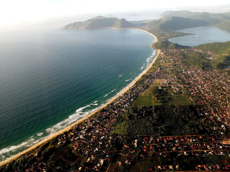
Almost all of the island's trails are in municipal and state parks, free entry, a guide is not required. Short and easy: to the natural pools of Barra (600 m, 15 minutes) and to Cachoeira do Poção (710 m, 22 minutes). Medium: Naufragados (2.3 km, about an hour) and Costa da Lagoa (7.5 km, 2.5 hours). The most incident-prone — Lagoinha do Leste: since 2016 it accounted for 42 of 371 calls to rescuers for trails in Greater Florianópolis. Emergency number — 193.
How not to end up in the rescuers' reports
Advice from Corpo de Bombeiros and FLORAM: check the forecast before leaving, do not leave the trail, wear sneakers or boots, take water, repellent and sunscreen, do not go alone, be careful on wet rocks at waterfalls and on cliffs. Corpo de Bombeiros also recommends a GPS app, warm and waterproof clothing and telling someone your route.
Local guides (condutores ambientais locais) are licensed by FLORAM; its registry has 15 people. No municipal trail requires a guide; on the island of Campeche trails are only with a guide (Beaches of the south of Florianópolis — Campeche, Armação, Matadeiro, Lagoinha do Leste, Naufragados). Which park has which trail and what is prohibited there — in Parks and reserves of Florianópolis — who manages, what is allowed, where to swim. Times below are one-way, according to measurements by NSC Total.
Trail to Lagoinha do Leste — Trilha da Lagoinha do Leste
Area Pântano do Sul, map point -27.7786, -48.4975.
Two routes to the wild beach of Lagoinha do Leste: a short steep one from Pântano do Sul (about 2.2–2.3 km; by NSC's measure, 51 minutes and "difficult") and a long one from Matadeiro. Another piece by the same outlet gives about two and a half hours and medium difficulty; time depends on pace and weather, and you should allow a margin. Return by the same trail: the coastal bypass is dangerous. In one case, five lost hikers were lifted out by helicopter after twelve hours of searches.
Pico da Coroa — Trilha do Pico da Coroa
Area Pântano do Sul, map point -27.7787, -48.4880.
The summit of Morro da Coroa on the southern slope of Lagoinha do Leste park, for the panorama. In 2024 Civil Defense closed the Pico da Coroa rock for several days due to risk of collapse.
Trail to Naufragados — Trilha de Naufragados
Area Naufragados, map point -27.8253, -48.5618.
From Caieira da Barra do Sul to Naufragados beach on the southern tip of the island, inside the Serra do Tabuleiro park: 2.3 km, about an hour, medium difficulty. Bus 561 runs to the start from the TIRIO terminal. The beach is described in Beaches of the south of Florianópolis — Campeche, Armação, Matadeiro, Lagoinha do Leste, Naufragados.
Natural pools of Barra — Trilha das Piscinas Naturais
Area Barra da Lagoa, map point -27.5730, -48.4180.
From Prainha da Barra da Lagoa: 600 m, 15 minutes, easy. Inside Monumento Natural da Galheta. The pools are between rocks in the open ocean; when there are waves they are dangerous.
Trail to Galheta — Trilha da Galheta
Area Barra da Lagoa, map point -27.5822, -48.4227.
Trails to Galheta beach from the Barra channel and from Praia Mole, both inside Monumento Natural da Galheta. There is no official length. On the trail from Mole there have been reports of thefts and assaults; better not to go there alone. The beach is described in Beaches on the east of Florianópolis — Moçambique, Barra da Lagoa, Galheta, Praia Mole, Joaquina.
Costa da Lagoa route — Caminho da Costa da Lagoa
Area Costa da Lagoa, map point -27.5525, -48.4625.
Walking path along the west shore of Lagoa da Conceição to the settlement of Costa da Lagoa, which has no road access: 7.5 km, two and a half hours, medium difficulty. The branch from Costa da Lagoa to Ratones — 1.8 km, 40 minutes. Many return by boat.
Cachoeira da Costa da Lagoa waterfall
Area Costa da Lagoa, map point -27.5436, -48.4638.
A waterfall in the REVIS Meiembipe reserve. Reach it via the Costa da Lagoa trail or by boat to pier 16: the entrance is about 100 m from the village street.
Cachoeira do Poção waterfall
Area Córrego Grande, map point -27.6153, -48.5051.
The most visited feature of Maciço da Costeira park, in Córrego Grande, in the city: trail 710 m, 22 minutes, easy. The waterfall is about 8 m, the pool about 3 m deep, the water is cold, and it gets crowded in summer.
Cachoeira da Solidão waterfall
Area Pântano do Sul, map point -27.7941, -48.5380.
At Solidão beach: about 400 m and 15 minutes from Rua Inério Joaquim da Silva, roughly from number 1280. Drop about 3 m, depth of the pool unknown — jumping is prohibited.
Cachoeira da Gurita waterfall
Lagoa do Peri, map point -27.7501, -48.5392.
In the Sertão do Ribeirão zone of the Lagoa do Peri park: three cascades with three pools and the ruins of the Engenho de Farinha do Vitorino flour mill. There are many rocks, so take care.
Morro do Rapa trail — Trilha do Morro do Rapa
Area Praia Brava, map point -27.3894, -48.4174.
From Praia Brava over the hill to the northern Lagoinha: 2.8 km, one and a half hours, medium difficulty. The beaches are in Beaches of northern Florianópolis — from Daniela to Santinho.
Dunas da Joaquina
Area Joaquina, map point -27.6221, -48.4499.
Sand dunes at Joaquina in the Dunas da Lagoa da Conceição municipal park; sandboarding on the dunes is permitted by the park rules.
Mirante do Morro da Cruz
Center of the island, map point -27.5885, -48.5338.
Viewpoints of Morro da Cruz park with views over the center and the mainland; the park has parking, toilets and short trails. The park itself is in Parks and reserves of Florianópolis — who manages, what is allowed, where to swim.
Morro das Aranhas
Area Santinho, map point -27.4722, -48.3801.
Site of the private reserve RPPN Morro das Aranhas. Height 255 m above sea level. Summit.
Morro do Lampião
Area Campeche, map point -27.6703, -48.4928.
Height 213 m above sea level. Summit.
Mirante da Boa Vista
Area Barra da Lagoa, map point -27.5847, -48.4248.
Viewpoint.
Morro do Ribeirão
Area Ribeirão da Ilha, map point -27.7198, -48.5499.
Height 512 m above sea level. Summit.
Mirante da Beira Mar
Area Centro, map point -27.5898, -48.5621.
Wheelchair accessible. Viewpoint.
Morro da Boa Vista
Map point -27.7717, -48.5552.
Height 302 m above sea level. Summit.
Morro do Pântano
Area Pântano do Sul, map point -27.7838, -48.4942.
Height 330 m above sea level. Summit.
Sources
- T2NSC Total, 7 Feb 2024 — trails of Florianópolis with length, time and difficulty; advice from Corpo de Bombeiros and FLORAMnsctotal.com.br · secondary source
- T2NSC Total, 6 Jul 2025 — Lagoinha do Leste: 42 of 371 lifeguard calls to trails since 2016; closure of Pico da Coroa in 2024nsctotal.com.br · secondary source
- T2NSC Total, 6 Jan 2024 — island waterfalls: Pouso, Costa da Lagoa, Solidão, Guritansctotal.com.br · secondary source
- T1FLORAM — protected areas of Florianópolis: which trails and waterfalls are in which parkpmf.sc.gov.br · primary source
- T1FLORAM — registry of local guides (condutores ambientais locais), valid until 10 Nov 2027pmf.sc.gov.br · primary source
- T2Wikipedia — Praia da Lagoinha do Leste: two trails and a dangerous shoreline bypasspt.wikipedia.org · secondary source
- T2OpenStreetMap — trail and waterfall points on the map, © OpenStreetMap contributors, ODbLopenstreetmap.org · secondary source
- T2openstreetmap.org — location of the place on the mapopenstreetmap.org · secondary source
- T1observa.ufsc.br — The private reserve RPPN Morro das Aranhas is located here.observa.ufsc.br · primary source
- T2openstreetmap.org — location of the place on the mapopenstreetmap.org · secondary source
- T2openstreetmap.org — location of the place on the mapopenstreetmap.org · secondary source
- T2openstreetmap.org — location of the place on the mapopenstreetmap.org · secondary source
- T2openstreetmap.org — location of the place on the mapopenstreetmap.org · secondary source
- T2openstreetmap.org — location of the place on the mapopenstreetmap.org · secondary source
- T2openstreetmap.org — location of the place on the mapopenstreetmap.org · secondary source
T1 — primary: law, agency site, price list. T2 — secondary: press, specialist sites. T3 — other.